BLUFF to TIMARU
Monday, 20 May. This would be the official beginning of our ride.
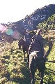
The main road was only two lanes, a 1 metre shoulder on each side, and it was also very busy, with many logging trucks and container trucks bringing loads of meat, fish, wool, dairy products and no doubt granite into the bustling port of Bluff. However, with D'Artagnan in front, and Tom behind, the horses didn't bat an eyelid at the traffic.
The sky was grey, suggesting a fog coming up from the Antarctic regions, or imminent rain, but the silvery sky showed the area up to best advantage - calm water shimmering with reflections as we rode through the tidal wetlands.
Bluff is a small industrial area, best known for its port, fishing industries and as the departure point for people going over to Stewart Island, the third 'large' island which makes up New Zealand, known and loved by many for its wilderness areas.
It's also a word which goes with oysters - Bluff Oysters, which come from deep down in Foveaux Strait, are very popular when the season opens in June each year.
On the other side of the Bluff harbour is the Tiwai aluminium smelter. Bluff also had a thriving meatworks up until recently, when 'Ocean Beach' was closed. However, I was told that the economy was recovering.
We rode past the very old hotels and shops reminiscent of boom days, down past the Paua House, owned by Fred and Myrtle Flutey, a focal point for tourists. The inside and outside of the house, as well as the garden, have been decorated with the shells of the NZ Paua (abalone).
From the road we could see 'vines' growing up the walls, with huge flowers the petals made from complete Paua shells. What a shame there was no Paua hitching post, or we could have paid the Fluteys a visit.
We turned the corner to Stirling Point, which was the site of William Stirling's whaling station in 1836 and considered to be the most southern point in NZ (even though it's not!). From here we had a full view of Stewart Island with its peaks on the north-western side over the Foveaux Strait.
We had some good trots on the way back along SH1 through the wetlands, and returned to Greenhills safe and sound. Ron and Ann Barr had been grazing our horses for the past few days, and had invited us to spend our last night with them to make our departure even easier. This is what we had been told to expect - Southern hospitality.
With their three young daughters - Melissa, Rebecca and Jemma - they owned a small farm at Greenhills. Ron and Ann worked for the same fishing company, Ron as a marine engineer and Ann in the packing house. They had just bought a larger farm a short distance further north or their present property. As Ron's own working dog was reasonably old and his daughters had been admiring Zig, I asked him if he'd like to own her. When we phoned them that night, Zig was no longer in the kennel, but asleep in front of the hearth in their lounge!
It took us three or four hours to ride to Steve Byers' 155 ha dairy farm on the back road east of Invercargill, only 12 kilometres away. And it was not without its adventures!
The highway was so busy. We picked Brae up and put him on D'Artagnan, in front of my saddle, and we formed a long single file, with Kia Kaha in the middle, Lisa bringing up the rear.
However, as we started across the bridge the horses decided they didn't trust it. There was no traffic approaching from the north, but behind us an articulated petrol tanker was coming. And coming. And kept on coming.
The horses were crossing very reluctantly, and slowly, and the truck driver seemed to be coming closer and closer until at last he skidded on the tarseal to stop just before coming onto the bridge.
A close thing!
Now a misty rain began to fall. It had been raining in the morning and the weather had not looked as though it would improve. Sure enough, it gradually deteriorated. Lisa had worn her raincoat, but I was wearing just a woolen sweater.
I decided to wait until we were off the main road before I put on my coat. I was to pay a few days later, when I got bad bronchial asthma.
I passed Brae to Lisa and he rode on Tom for a way. Both horses were settled with the dog on board, which made things easier and Brae soon got into the hang of sitting there, although it was probably more difficult for him on my Western saddle with the horn.
Fortunately the road had a good wide verge, and we kept to the side, keeping on plodding onwards. I had to remember to guide Kia Kaha around the roadside markers, which these days aren't made out of timber but out of plastic, and bendable. On one occasion I misjudged and the surcingle strap caught on the marker, bending it down until Kia Kaha had passed on, whereupon it rebounded with a whang right in Tom's nose!
Poor Tom! He did get a fright. He jumped out towards the middle of the road and Lisa cried out. I turned, just in time to see Brae, half being tossed, half jumping away, into the middle of the road. As if this wasn't bad enough, it happened just as an articulated truck was approaching from the rear, and as the driver applied the brakes, the load began to jack-knife! I went sick as I watched it all happen.
Both Brae and the driver recovered. I was more careful of the roadside markers after that!
There were lots of deer farms en route, and the stags were 'roaring', a mating ritual. The sound is not so much a roar but an eerie ghostlike sound! The horses didn't like it.
Eventually we got to the back-road to Tiwai Aluminium Smelter and turned off. It was only a few kilometres now to Steve Byers' dairy farm - thankfully. It was dusk, misty, grey by the time we arrived.
On Steve's farm they milk 400 cows for town supply. His farm is not fully organic, but they use a lot of organic fertiliser, and he is striving to improve his relationship with the environment... but at the same time, has to please his bank manager.
'Town supply' or 'winter milk' means that the farm has to provide the dairy company with a certain amount of milk all year round. Most dairy farmers produce milk for ten months of the year, and this milk is used to produce cheese, yoghurt and other milk products - but not necessarily fresh milk for consumption.
On these farms the cows are all calving during two months of year during the Spring, when the grass is growing rapidly in the warm, wet conditions. On a 'town supply' farm the farmer will arrange it so that some of the cows also calve in the Autumn, so that milk can be in produced all year.
On Steve's farm he has a row of huts where WWOOFers can stay. The horses were given a beautiful, sheltered paddock with deliciously smelling hay for the night. We were swallowed into the warmth and dryness of one of the huts, where we were cooked a delicious dinner by Val, one of the workers. Another taste of wonderful Southland hospitality!
Lisa and I made a good start the next day, but it was not to last long. At first the topload gave us more problems, and needed to be readjusted. Then my new saddlebags started to come apart at the seams. We stopped, removed the saddlebags, and I called Post Haste Couriers and the local saddlery to arrange for their quick repair.
We left the saddlebags for the courier, and started again but after about ten metres noticed that the packsaddle girth strap had broken. So now Kia Kaha was fully unloaded and all of our goods and possessions given to the courier.
Arrangements were made for the packs to be returned to us by our overnight host, who worked in Invercargill and we set out once again for Gorge Road.
The road led us to the very edge of the Waituna and Awarua Wetlands, 14,000ha - the largest area of protected wetland in southern New Zealand,adjacent to the Tiwai Aluminium Smelter. These areas have been recognised as an important feeding and resting ground for birds that migrate from the Northern Hemisphere.
There are also natives such as Fernbirds and Bitterns, so the area is popular for observers watching the many wading species as well as being sought after keenly by fishermen.
It was a long, straight road, 3 or 4 kilometres between intersections. Earlier in the century the railway line had run alongside the road all the way to Toknaui, and there were tell-tale signs of where it had once been.
We had hoped to speak to the children at the Gorge Road school, but were told by the principal that the school was 'too busy'. Instead we rode for 2 km towards the Waituna Valley and found the farm of Dave and Frances Stuart, our overnight hosts on a lovely, lush sheepfarm. They have been farming in the district for many years, and we had a pleasant overnight stay with them.
Next morning was frosty with a hint of the wet weather to come. Dave went to shift the sheep for the day's feedbreak - sheep are kept behind electric fences so that they get sufficient but not too much grass each day, and the paddocks can then be rested for a longer period until the growth is sufficient to put the sheep on them again. Another benefit is that the grass (growing in soft mud at this time of the year) gets less trampled, and therefore is quicker to recover and grow again.
In the north we only breakfeed cattle. It seemed unusual to see huge mobs of sheep behind electric fences, but I was soon to get used to the idea!
We caught and saddled the horses. We needed to get moving if we were going to avoid the worst of the weather. But before we had gone too far the rain had set in - fortunately coming from behind us.
As Lisa and I rode past one farm we could see a man shouting out at us - the constant clip-clop prevented us from hearing. Stopping the horses, we gathered he was offering us a cup of tea, and rode into his yard for a chat and a cuppa. He had seen our photographs in the paper, had passed us in his car the previous day, and was therefore keeping an eye open so that he could add us to his list of celebrities that he'd invited home to visit!
Winding down onto the flats by the Mataura River and Titiroa Stream, for a while we trotted alongside the river abundant with birdlife. Then into Fortrose, where we turned left uphill and over rolling country to Tokanui.
When we returned to the paddock we were just in time to see a thunderstorm with heavy rain rising over the hills. We decided to stay put for one more day! My bronchitis would not have been up to riding in those conditions.
However, we DID leave Tokanui the next day (Saturday), and hadn't been aboard for long before the rain came down again. We only rode 12km to Quarry Hills, to be hosted by more folk in the district - Mike and Pam Callahan, and their family - Winston, Sam, Jake and Laura, who farm 413 ha with beef, sheep, and deer.
We had 'found' the Callahans after many phone calls - not originally intending to stay with them. Friends we'd stayed with at Lake Manapouri had told us of people who had ridden their horses along the beach at this point of the Catlins Coast. I'd make inquiries and contacted Mick Callahan (Mike's father) to ask if we could stay in his crib at Dummy's Beach.
In the heyday of goldmining scores of diggers were working Dummys Beach and next door Long Beach. One of the companies formed in the early 1900s built a complex system of water races and generated power so as to operate night shifts in an effort to extract more gold. Remnants of the gold venture are still to be seen at Long Beach Creek.
The Callahans were happy for us to use their crib, but suggested we come to visit to discuss our plans. And when Pam saw how sick I was she suggested we stay until I recovered.
Over the week that we stayed we decided that a 'crib' with no power was not the best place for someone recuperating from bronchial asthma, so gave away our plan to ride along the coast.
The Callahans couldn't have made us more welcome; even Brae was welcomed into their home and soon was competing for the best spots to sleep, and best food to eat, with their little Fox Terrier bitch called 'Tammy'.
Throughout Southland I was impressed... amazed by the people - people such as the Callahans and their kindness, generosity and their values.
On the Saturday it dawned frosty and clear. Laura played netball for the local school and Pam invited us to go along and watch. It was a cold day, and I sat out of the wind - I'm not too keen on sports, but was interested in the community aspect of the event. Laura played in a school team which had two boys - schools in NZ are encouraging gender balance in all sports. There were three courts, and for the few hours that we were there they were packed with players, all from the district.
It was the community meeting place... bystanders and parents catching up on the local news as they watched their family members and other local teams doing their best. There were school teams, adult teams, 'golden oldies'.
Above the shouts and cries of the players and supporters, friends greeting friends I could hear the calls of many birds, so went to explore. Across the road from the courts there was a long windbreak of eucalyptus trees, and the bellbirds were feeding here, flying from tree to tree, competing and calling with sounds reminiscent of the 'Close Encounters' movie. It was obviously some game or competition, because they didn't seem too desperate to be gathering the honey.
I walked into the paddock behind the trees and looked beyond to the hill, a rumpled patchwork quilt of break-fed fields, beef cattle and sheep, toitoi windbreaks. A clear, beautiful sky above.
The ranges of hills in Southland are something to see... they run in long lines from north-west to south-east, and are steep and mostly covered in native forest.
In all we stayed eight days whilst my health improved, but necessitating several trips to the medical centre at Tokanui.
On the day after we joined them, Mike and Pam had taken us on a delightful tour of the district even though the weather was cold, windy and wet. The sea was furious, exciting stuff.
The coast is wild and, in the winter, virtually uninhabited except by seals, penguins, sea-lions and seabirds. The surf can be really raging, as it was when we went down to Waipapa Point, near Otara, truly the most southern point in New Zealand. This is the site of New Zealand's most disastrous ship wreck, when the SS Tararua foundered with the loss of 131 lives.
The Tararua was bound for Melbourne in Australia, having left Port Chalmers (Dunedin) on 28 April 1881. The next morning at 5am she ran aground on the reef at Waipapa. A boat with four sailors and a passenger was launched to get help, and halfway to shore the passenger, G L Lawrence, dived into the sea and swam to the beach. He began running to restore his circulation and get warm, and spied the Otara station.
Giving the alarm, a stationhand set out with two horses, riding for Wyndham - about 60 km away, which he reached three and a half hours later. Heavy seas and pounding surf made rescuing the passengers a difficult job, and only twenty people in all were saved.
Leaving our car, Mike, Pam Lisa and I walked to the Tararua Acre, where most of the dead were buried, in a paddock not far from Waipapa Point.
East of here is Curio Bay, where there is petrified forest on a rocky platform to be seen at low tide. The fossils were created by a volcanic eruption, when they were covered with larval mud and debris some 160 million years ago (Jurassic Period). Hardened into rock by the motion of the sea, the fossils are well worth looking at.
And then we drove on to the small settlement of Waikawa. Here you can visit the Dolphin Information Centre, and if the conditions are right, go out with Koramika Charters to watch the Hectors Dolphins, the world's smallest and rarest. There's also yellow-eyed penguins returning to their nests near the harbour entrance. If you're into birdwatching you'll be truly surprised at the variety at Porpoise Bay - spotted shags, pied oystercatchers, terns, gannets and little blue penguins.
The Catlins coastline is the only part of the east coast of the South Island where the original forest still extends down to sea level. The Forest Park comprises 60,000 hectares of tangled wilderness, made up of Rata, Kamahi and podocarp forest. The mountains aren't high, up to 700 metres, but the small rivers draining them form an intricate trellis-like pattern, flowing through deep gorges before emerging in peaceful estuaries like those of the Catlins, Tahakopa and Waikawa Rivers.
Once there were seventy sawmills in the district. The small Glenomaru Sawmill, on the site of the old railway station, is a colourful reminder of a once thriving industry. Not far away was Begg's Twine Mill, at Romahapa. The large upright concrete cylinder by the Glenomaru Stream about 2km south of Romahapa was the turbine fed by a water race that drove the machinery of A S Begg's twine mill. It was established in 1891 and closed about 1937. The line of the old water race may be traced across farmland to a dam on the Glenomaru Stream.
The Catlins is an outstanding scenic, historical and ecological experience I'd never appreciated before. The sedimentary rocks have been carved into a range of features - cliffs up to 200 metres high and a wide range of caves, blowholes, arches, rocky islets and headlands, with many natural beaches in between, and intact foredunes covered in Pingao and other native sand-binding plants.
Because we'd changed our plans and didn't intend riding along the beach, we rode to Chaslands, and here Mike introduced us to one of his clients; as well as farming he ran a rural cartage business.
Tommy Chasland was famous for his excellent seamanship, hunting skill and good humour, but is today remembered by a mistake - he mistook a headland for Otago Heads. Chaslands Mistake was also the scene of another shipwreck (one of many) on 4 December 1876, when the passenger steamer Otago became wedged between two pinnacles of rock and was totally wrecked, fortunately without any loss of life.
There once was a Chaslands school and a Chaslands community, but now it's just a mark on a map. We decided that we would ride the horses through to Chaslands and the McKenzie's farm, return to the Callahans' to stay the night, spend another day in Invercargill to tie up some loose ends, and then the next day ride in earnest from Chaslands onwards.
To leave the Callahans' was heart-wrenching - not only for Lisa and I, but the family too felt they would miss us - and Brae also was not keen to leave little Tammy behind.
Lisa and I had a delightful ride along the Southern Scenic Route and through the Catlins State Forest Park with its myriad of greens. We climbed up the sealed road and down the other side where the seal changed to slushy loose metal.
The surface was good enough to let the horses have their heads and canter. When we stopped for a breather we looked behind - to find a mud-specked Brae who had managed to keep up quite easily (he LOVES running) but the horses had splashed mud all over him. It later hang in dreadlocks from his coat.
It wasn't long before we reached the farm of Shirley and Ken McKenzie. As Shirley said, unfortunately the cartographers haven't updated their maps since Chaslands lost their school and community facilities, and to tourists Chaslands still looks like the sort of place that might boast a store or petrol station.
Shirley and Ken have a large property where, amongst the other livestock, they pretrain standardbred horses, taking them on to trainers in trotting towns like Winton for their trials and race training. Both have had some successes - but no doubt we didn't hear too much about the ones that didn't do so well.
We unsaddled the horses and put them in their paddock for the night, with Ken promising to feed them some hay later. Shirley offered to run us back to the Callahans, and suggested that she drive us further north to show us the lie of the land and introduce us to the right people.
We spent the afternoon and evening visiting the spectacular Cathedral Caves - one of the most famous features of the area. They were named by Dr T M Hocken in 1892 because of their resemblance to a cathedral, and you can get in safely at low tide. The first two caves are the most spectacular - over 30 metres high and cut well back into the cliff. The caves have been formed by erosion along joints or small faults.
We couldn't have got down to them on horseback - the stock-track was overgrown and we couldn't have left our horses and packs in the car-park, a good ten minutes' walk away.
From there Shirley showed us the Tautuku Peninsula, the village, and introduced us to 'horsy people' at Papatowai as well as John Burgess, a keen horseman, and Rodney McDonald, who ran the local backpackers where we could stay.
In the 1840's a whaling station was set up on the Tautuku Peninsula and it later became a port for timber and flax exports. Now there are many cribs there which are only accessed at low tide by crossing the Tautuku River mouth.
Shirley pointed out the Lenz Reserve and Tautuku Lodge, which are set on 550 ha of valuable native bush incorporating the Fleming River basin. These were purchased by the Royal Forest and Bird Protection Society in 1964 with funds from the estate of Dunedin's late Mrs I Lenz. Today they own a modern, comfortably equipped lodge here for members. We saw a track that partly follows an old tramline (with some early milling relics restored) crossing the southern half of the reserve.
Pam returned us to Chaslands by car the next morning and we saddled up in a hurry, anxiously awaiting a television crew who were intending to drive out from Invercargill. We rode through more cool dripping rainforest, at times with many bellbirds singing alongside us, and hardly a vehicle passing us by.
Arriving at Tautuku Beach Road, we descended down the track and unsaddled Kia Kaha whilst the horses grazed. Why take our load for a gallop along the beach towards the Peninsula? We left it on the beach, and took Kia Kaha (Doug) without his load.
At first Kia Kaha and Tom were afraid of the surf as it crashed in from the Pacific, but after a time they got used to the surge of the waves around their feet. It was a fantastic day - blue skies, just Lisa and I and a barking Brae yapping at the horses' heels. Lisa and Tom galloped whilst we sat and watched.
Leaving Tautuku Beach we climbed Florence Hill and then weaved our way through the bush again down to Papatowai. I went in to the shop (this was a rare experience!) and found that they sold hot chips AND Speights beer. Even though Lisa had declined an offer of an ice-cream I took beer and chips back to the carpark (now a horsepark) and we sat on the rails and munched and drank. Fortunately, we didn't drink enough to be bothered by the drink/drive restrictions!
It was only a few more kilometres to the farm of Rodney McDonald, where he has restored an old schoolhouse, opening it to backpackers. His Weimaraner pup, Katy, was delighted to meet Brae and learn all about his travels no doubt. Hanneke Akkerman, a German backpacker, was also staying and cooked us a delightful dinner of chicken and vegetables. Beautiful!
We enjoyed our evening and the company and slept well. The next morning we discussed a plan with Rodney, who was intending to ride his horse as far as the beach with us to show us the way through the river, which had areas of quicksand.
As Hanneke wanted to go to the chemist at Owaka we suggested to him that she could take Kia Kaha's packs in the vehicle, and Rodney, using his own saddle and bridle, could ride Kia Kaha. This plan met with approval, so when his farmwork was complete we set off across the Tahakopa River to get access to Papatowai Beach.
We were fortunate that Rodney knew where to ride - although we were wondering if he was so sure as the river got deeper and deeper. Soon our own feet were under water - we had to lift them onto the horses shoulders to keep them dry. And then it was all over and D'Artagnan was walking up the steep sandy bank on the other side.
I wondered how they locals knew there was quicksand. Had people or cattle been lost, swallowed up by the black, gooey mess? I voiced my question to Rodney, just as D'Artagnan began to plod through sand which was 20 or 30 cm deep. Suddenly my own feet were touching the ground - D'Art's feed had disappeared.
I panicked, leaping off, thinking he must have walked into quicksand, but this clever horse had fooled me. Horses love to roll in soft sand, so if they get the opportunity they will very quickly lie down and roll.
What had surprised me was that all four legs had gone down at the one time - usually horses lower themselves one end at a time. I'd have to watch out for this in future!
Persuading him to stand again I led him across to a tree stump on the beach and sat there waiting to get my breath back. The saddle seemed okay - fortunately. It would be easy to break a saddle tree. Lisa and Rodney rode back (they'd ridden their horses on to hard sand, where they wouldn't roll) and I mounted again.
It was delightful riding on the beach - if you have ridden along roads and in traffic, you begin to appreciate the kindness of the conditions. We kept a wary eye for sea lions, which terrify horses, but all we saw were waterlogged driftwood and huge clumps of kelp.
I noticed that there were tracks around many of the pieces of kelp and timber, and Rodney rode over to investigate.
"Deer!", he called. "There must be deer on the beach in the mornings."
At that point we watched as some of the deer ran around on the hills above us, in and out of the forest, watched by a mob of cattle. They didn't seem to belong to any particular paddock, but that wasn't bothering them.
 Approaching the northern end of the beach, and towering cliffs, we walked away from the beach to find the track leading to the Old Coach Road. The early settlers would have quite enjoyed finding a beach like this to use as their road.
Wide enough for a vehicle, the Old Coach Road was only now traversed by walkers, horse riders and occasionally four wheel drive vehicles. It gave us a spectacular view of the coastline right back to Florence Hill, and the interesting wetlands behind the sand-dunes.
At one point we came around a corner and on the corner above us a stag, approaching 12 points, stood, challengingly, but just as quickly he shot off into the forest. I've never been so close to a wild stag!
We rode past what would have been small communities - Purakauiti, Purakaunui, Ratanui and Hinahina, calling in on John Burgess for lunch, giving him a welcome break from his fencing.
And then just down the road, whilst Rodney held our horses Lisa and I made the short pilgrimage through well-signposted and described native trees to the Purakaunui Falls, the subject of many paintings and photographs. These are spectacular and well worth the ten minutes walk to the bottom.
Over the bridge at the 'back side' of Owaka, we rode in to find our paddock behind the Owaka pub, and the motel across the way. It wasn't long before we were sitting in the pub lining up handles of Speights!
Owaka is the largest township in the district with a shopping centre, garages, post office, hotel and medical centre. The locals pronounce the first 'a' as in lack', whilst I am endeavouring to use the correct Maori pronunciation with the long a, as in 'past'. We got into many arguments.
The locals are strong on their history and the Catlins Historical Society has a museum in Waikawa Road. There's also a Catlins Visitors Centre near the hotel and the Department of Conservation has local headquarters with a display room and a Catlins Summer Nature Programme. Hunting permits, brochures, maps and other information are all available here.
The Owaka pub had featured in the 'Heartlands' TV programme, and one of the shots was of the owner's dog who had a passion for potato chips, being able to open the packets himself and devour them without a trace. The only thing the dog didn't do was put his litter in the rubbish bin.
Next door to the pub the restaurant served a delightful dinner and we shared a pleasant evening with our friends, Hanneke and Rodney.
We decided to stay in Owaka for two days, and contacted Lawrie Latta, a recommended farrier, to get him to re-shoe the horses. Already D'Art had worn through a set of shoes and the other two horses' feet looked like they needed attention too. Lawrie makes his own shoes, so I was given the job of measuring the horses' feet, and phoned through the measurements to him.
Whilst we waited in Owaka, I took the opportunity to visit Kitty Burgess, John's mother, who knew a lot of the history of the Catlins. She was fascinating to talk with.
We had the horses shod the next day; we had made plans to ride to Kaka Point that day. However, the work took longer than we envisaged and so I engaged a young woman in Owaka who would take our personal items and Kia Kaha's saddle through to Kaka Point, so that our trip would be quicker. I didn't want to be caught out in bad weather again.
When Lawrie was finished we trotted off towards Willsher Bay, and covered the 13 kilometres in 110 minutes, an average of 7.1 kph - a great improvement on our usual average of 6 kph.
We dashed up Tunnel Hill where there is a disused railway tunnel, 246 metres long, under McDonald's Saddle. This was the most southern railway tunnel in New Zealand and was part of the Catlins Branch Railway once linking Balclutha to Owaka, excavated with pick and shovel, horse and cart, it was completed in March 1895. Now it is a historical reserve, much favoured with trampers.
Willsher Bay played a prominent part in the early history of Otago. In 1881 a school, the Reomoana (voice of the sea) School was established here. Originally only Maori children were taught, but the second building accommodated both Maori and Pakeha children until 1929.
There is also a beautiful domain here, once the property of George Willsher who returned to England in 1859, donating the property he cleared as the venue for the great New Years Day Sports Meeting, held here for something like a century until 1962.
That night, to the north we could see the street lights of Kaka Point, a rocky promontory. The permanent population here is under 500, but at holiday time the number swells considerably - many people come from other parts to enjoy their holidays in their "cribs", whilst the house is invaded by visitors from overseas as well as other parts of the country.
The next morning there had been a lot of snow in the Otago area, whilst at Kaka Point the beach was covered in heavy hail. I phoned a local farmer, Les Dunn, and asked him if we could buy some hay for the horses, and he was quick to deliver a bale of luscious hay, even quicker to decline payment for it.
Les told us an interesting story of an event which took place in the district in 1909, giving the area considerable notoriety. At a local guesthouse a young man, the debonair and extraordinarily generous Percival Redwood, had been staying, winning the affections of the landlord's 32 year old daughter, Nessie. All of the evidence showed that this Percy was indeed a wealthy and appropriate match for Nessie and on 21 April 1909 the pair married with considerable money spent on the wedding.
However, the groomsman became suspicious of Percy's sexuality and called in the Police, who had been looking for a confidence trickster, a young woman by the name of Amy Bock, on charges of fraud, forgery and theft. As Amy was escorted off the wedding guests could not believe the crimes she had committed. Known also by other names - Shannon, Channel, Vallane and Skevington, Amy admitted all and was sentenced to two years hard labour for her latest confidence trick. However, her sentences totalled more than sixteen years and she was declared a habitual criminal.
Les had named two of his trotters after the incident - Percival Redwood and Amy Bock.
He drove us down to The Nuggets, about twenty rocky peaks in the ocean, and explained that the boat landing at Tirohanga nearby is quite unique, with the fishing boats being winched onto the beach until they are quite high above the tide-line. At times up to twenty boats operated from here - now there is only one.
Nugget Point is the only spot on our ride where we could have found NZ fur seals, elephant seals and the Hooker's sea lions living together - but we didn't see any of them, or the hoiho, the yellow-eyed penguins, when we were there. In the summer it is a very popular place for tourists, and I was told that 30,000 visitors call here to see the marine wildlife anmd the spectacular cliffs which rise 133 metres above the sea. The rock formations appear stacked.
Local Maori didn't live near The Nuggets as they found it too exposed, but would have been an important point for food (kai) gathering. The white painted lighthouse was built in 1870 from stone from a quarry nearby. Originally lit by oil-fired lamps it was converted to electricity in 1949 and lately has become fully automatic with no lighthouse keepers living nearby.
Kaka Point is very close to the original mouth to the Clutha River, and once schooners and steamers plied the waterways here with a thriving township growing. This was to become the new "Edinburgh of the South".
Nature played a cruel trick on the developers though - the Clutha River, or as it was first known, the Molyneux, had other plans. In 1878, there was a devastating flood, so bad it became known as the "Old Man Flood', sweeping from the mountains right down to the sea. The lower Clutha basin (including the towns of Balclutha, Stirling, Inch Clutha, Kaitangata and Port Molyneux) was covered with a sea of water, with incredibly high losses of homes, stock and property.
On 14 October the bridge at Beaumont came floating down on the swollen river and slammed into the Balclutha Bridge with such force that later that day it too was swept away, having only been built some ten years previously.
So great was the collection of debris at the river mouth - dead animals, houses, bridges, tree stumps - that the sandspit across the harbour gave way and a new river mouth was formed.
After a few days we rode out - the weather was much milder and the ice was melting. This part of New Zealand was first settled by the Scots, and in Scotland in 1846 they decided the river should be named 'Clutha', the ancient name for the river Clyde on which Glasgow is situated. The Maori name is Matau (right hand) because when they entered the river in their canoes from the ocean they had to turn the prow to the right to paddle up that branch of the river, it being safer to navigate.
When Captain Cook arrived in 1770 he called the river and the harbour "Molyneux" after Robert Mollineux, the sailing master of his ship "Endeavour". However, the Scottish decided that these names were both meaningless and unpronounceable and feeling sure that the river mouth would soon become the site of an important town, it should be considered as the "Glasgow of the South".
Just as the Clutha River has had various names, so has Balclutha. Originally it was known as Iwikatea (iwi = bone, katea = bleached) as in 1750 there had been a battle amongst the Maori tribes and the bodies of the defeated were left to decompose, with the bones whitening in the sun. From 1853 to 1858 and prior to the bridge the settlers would cross the Clutha River and it became known as "The Ferry".
Later the Scots named the town Balclutha (town on the Clutha). The present bridge which was opened in 1935 is a landmark and a source of pride to the people who live here.
Just south-east of Balclutha the mighty river divides, with the southern fork being known as the Koau (pied shag) and the northern the Matau. I was intrigued by the name Inch Clutha but learned that inch is an old word for island, and indeed this is a flat island of very fertile river loam, which can be accessed from two bridges across the Matau.
The 630 ha property of Telford Farm is well known in New Zealand - formerly as a farm training institute but now recognised as a rural polytechnic teaching agriculture and horticulture. The main building here was once a magnificent stone homestead, built in 1869. In those days it cost more than L3000 - a considerable expense in those days. It is still a grand building today, serving not only as the administration centre of the school but also as a fine memorial to the Telford family, who with public-spirited generosity donated with property to New Zealand as well as a living memorial to the people who saw the Telford family's dream through to fruition.
As we rode north we saw the remains of the chicory mill at the northern-most end of the island. The chicory farm here operated for more than seventy years, growing, harvest and supplying dried chicory roots to the coffee companies of New Zealand and overseas. Unfortunately, in 1956 the protective tariff was lifted from imported chicory and it was found to be cheaper to import the root from overseas.
Balclutha was the first built up area that we had ridden through. We had to take the horses through the township and over the beautiful Balclutha River Bridge, then along the road beside the quarry to Barnego.
We hadn't been on the road to Stirling long the next day when we came across the old stone railway bridge across the highway. The bridge sits on a foundation of solid rock and has a span of some ten metres across the road, joining on to the steel structure which brings the railway across the river. The hard blue glacial stone of which the bridge was made was hewn out of the hillsides on a farm some 5km north of Balclutha.
There was a lot of traffic on this narrow highway. I looked vainly for "Mt Coo-ee," a property known well in those early days. Travellers wishing to reach the island would call out "coo-ee" across the river, usually attracting the attention of one of the Inch Clutha residents who would then row a boat across to collect the visitor.
Kaitangata was well known for coal. Apart from the traffic it was a delightful ride alongside the willowed wetlands of Lake Tuakitoto, over rolling countryside to look down on the flat pastureland around Milton - Lovells' Flat, Adams Flat, Moneymore.
The hills in the background looked like a much rumpled patchwork quilt, with 'beading' of snow, hedges and pods of haylage lined against fences.
Moneymore was another community that was 'no more'. We passed the school and its proud gateway declaring its centennial. However, the school was now disused.
At last we came to Tokoiti, just outside Milton, and the farm of Adam and Glynn Paterson. Here they had over 1300 acres which ran right back to Mt Misery - 4000 stock units, or 3000 ewes and 80 Maine Anjou cattle. Their children, Mark, Tim and Jane, had decided they didn't want to follow a farming career so Adam had decided to sell the farm and retire to a warmer climate. He agreed with their decision - it was hard work to make a living from the farm, even though Tim was currently assisting him. Mark was studying Marketing at Dunedin University, Jane was still at high school.
And we could understand his desire for a warmer climate - the next morning it was snowing and the temperature was definitely icy. Adam took us for a drive to the back of the farm, where we had splendid views right up to Lake Waihola, just outside Dunedin. It would be glorious on a fine day.
When we left Tokoiti we headed north and over the Taieri Saddle to Taieri Mouth. This was a very high part of the country, with magnificent views of the coastline north and south.
The farms were huge and remote. A lone horse wandered down the road to greet us. We were afraid it might follow us and shut it into some yards, but when I flagged down a farmer and asked him about the 'lost' horse he said that it mostly grazed the roadside!
Three sheep also grazed the road further afield, but the closer we got - and the nearer Brae got - the more distant they got. In the end Lisa galloped off on Tom and herded them back behind us. We trotted away... for quite some distance, then realised that Brae was missing. His Shetland Sheepdog parentage had told him to take the sheep right home!
We rode through the forests south of Dunedin, watched by the occasional bellbird and wood pigeon, down to the Toko River, and up again to a great height for more splendid views of the coastline. It was a great day to be riding!
Descending we were often passed by huge forestry trucks, all credit to Tuapeka Transport who passed our cavalcade with great care. Evidently someone had warned them there were riders with three horses on the road, and each time a truck came upon us it drove very slowly until the driver was sure that the coast was clear. Courtesy beyond the call of duty!
Taieri Mouth was a delightful beachfront community, obviously frequented by Summer holidaymakers, although the river mouth had a thriving fishery business. Several boats came in and out of the river mouth as we rode down to cross the bridge.
Then it was along the beachfront straights to the property of Colin and Pat Harvey at Kuri Bush. We'd covered something like 38 kilometres that day.
Colin was another trotting man, whilst both were very involved in the Pony Club at Brighton, giving much of their time to such organisations. They were delightful hosts, and couldn't have treated us better.
The next day was a shorter ride, something like 15 kilometres, and much of it on the beach. It was a straight ride along the coastline to north of Brighton beach. The home we were going to, of Brenda Harland, was to be approached from the beach and up an estuary. I hoped we didn't get lost and find the quicksand instead!
It certainly was more pleasant riding along the beach. It was easier on the horses' feet and we didn't have to watch for traffic. Brae, also enjoyed dipping his feet in the cool water. The previous day he'd walked for something like 35 kilometres - not including the extra few he'd run herding those sheep back where they belonged.
Brighton was another popular holiday resort, although it's obvious that quite a few people live here and commute to Dunedin. In the sand dunes the northern side of Brighton there were many rabbits and Brae soon got wind of their scent, bounding after them - although he didn't look like catching any.
'Fish and chips' said the sign that flagged me down. I went to buy some lunch (not that I needed any!) and then to a petrol station where Lisa thought I was buying petrol for D'Art. The photograph she took does rather look like I'm expecting service!
After our delicious fish, we found our way down onto the beach again and rode around the heads and into the estuary. 'This will be easy', I thought. There were tracks from a single sulky and two trotters, one being led from the cart. They would probably lead straight to Brenda's stables.
We rode across some soft sand and I bore in mind what D'Art had done to me last time. Then there was a cry from Lisa: 'Oh! No! Doug'.
I turned around to see what Doug (Kia Kaha) was doing, and found he had decided to roll. Momentarily I forgot to keep D'Art moving, and down he went too. This time, however, my sweater and jacket caught up on my saddle horn, and I couldn't get off. I finally got my sweater and jacket unhooked, and one foot out of the stirrup when D'Art had decided to get up, and of course my other foot trapped me. I went crashing onto my back! At least the sand was soft - only my pride was dented!
Brenda's partner, Gordon McCraw, is a farrier who, with his small Foxy, Poi alongside, works in the district shoeing horses - children's ponies, heavy horses, gallopers and standardbreds.
Brenda and Gordon have been involved in the Otago Goldfields Heritage Trust Cavalcade, which is an opportunity for horse and pony riders and drivers, as well as some walkers (or those on "Shanks Pony" as they are referred to) to get together each year in November, recreating the spirit of our pioneers. The Trust is a non-profit making organisation and each branch of the cavalcade (or trail) is self-funding.
We were shown along the beach and around the dangerous parts of the estuary the next morning.
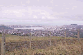 From Blackhead Road it was city streets around the St Clair Golf Club until we came across a magnificent view of Dunedin city. Dunedin is built on very steep hills, with some flat land, reclaimed from wetland at the top of the harbour, and we could look down right over Forbury Park. We dismounted, it was too steep to ride, and just had to make sure we took the right roads! It wasn't hard though, there was a passing rubbish truck that clanged up behind the horses and other motorists and pedestrians who were only too happy to point the right way.
As we entered the grounds the horses stopped dead, having a good look at the horses in training on the track. No doubt Kia Kaha and Tom remembered their earlier lives when they had worked out on the track.
We looked out for Roger Kingsland and Ray Wilkie, the caretaker and manager respectively, and found them at the stables where they'd prepared three looseboxes for our mounts. All of the trainers and owners who came in and out of the stables over the next few days were interested in what we were doing, and always willing to lend a hand or to offer advice or assistance.
The horses stayed at Forbury Park overnight, and the next day we rode through the streets of Dunedin, to be greeted in the Octagon, the city centre, by the Mayor of Dunedin, Sukhi Turner.
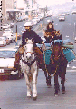 As well as the Mayor and her husband, Glenn Turner, a celebrated New Zealander, to meet us, there were friends from both Quarry Hills and Brighton. It was good having "supporters" there to help with Brae (dogs were prohibited from the Octagon) and the horses. I'd remembered to take a pooper-scooper, as I thought I should clean up any 'fertiliser' which the horses left in the city centre.
It was difficult to clean up after the horses as we rode down George Street, and I was told by a Dunedin City Council staff member days later that they had fielded numerous complaints about the 'deposits' we left outside the most prestigious department store in Dunedin, Arthur Barnett's!
We had been introduced to kind farmers at Pine Hills, Monica and Fred Ford, who had offered to graze the horses for us whilst we stayed in Dunedin.
Lisa and I had meanwhile found long-term accommodation in the Leith Valley Tourist Park, at the foot of the Pine Hills. It was a nice break from riding and I was most impressed with this southern piece of Scotland.
When we finally left Dunedin on Saturday, 29 June it had snowed overnight and we could see the snow above us on the hills, where the horses were. The road was steep and we soon hit fresh snow. We crossed the motorway by bridge then down a steep hill and up the reversed back the front wheels locked up and the car began to slide. This was a rental car... and I didn't want any dents in it.
We abandoned the car and Lisa went in to a nearby home to phone Fred Ford, the friendly farmer who was grazing our horses. He agreed to come in his tractor, but when he saw the greasiness of the road he was afraid the tractor could slide into the car too!
Things looked bad but Fred agreed to try backing the car back into a driveway, where he'd turn and then we could go back the way we came and delay our journey for another few hour.
We watched (my heart was in my mouth) as the rental car slipped and skidded down to the driveway, but Fred was obviously used to these sorts of conditions and completed it safely.
Lisa and I decided we'd spend an hour in Dunedin before attempting to get back to the horses, and, you know how it is... time just goes by... it was almost 2pm when we left Fred's home.
The road down into the Leith Valley was steep and icy in parts, but it was worth it when we reached the bottom as the ride up to the summit was delightful... at all times accompanied by the exuberant Leith tumbling down back to Dunedin. In parts the road was frozen and the horses picked their way daintily, but no snow fell.
At the summit we crossed the motorway (despite traffic determined not to slow down for these horses trying to cross their path) and rode down on the other side into the Waitati Valley. It was a delightful ride, with little traffic, beautiful rural country and glimpses of the coastline at Waitati township and beyond.
However, it was dark before we arrived at a tourist park, Orokonui, which is set in a valley at Waitati surrounded by conservation areas and reserve. Fifteen kilometres north of Dunedin, it's set in delightful grounds, with farm animals standing in tall trees - in fact NZ's tallest tree can be found here.
In the morning we got a better view of Blueskin Bay as we left. It was named after Te Hikututu, a Maori chief whose skin was so well tattooed that it took on a blue colour. In the late 1800's the area was a holiday retreat for the wealthy with its many secluded beaches and natural beauty.
The horses hadn't had much to eat overnight, so we rode them into Waitati and found a lush grass verge where we let them fill their stomachs. From there the next few kilometres were along the extremely busy main road, but it wasn't long before we turned onto the Coast Road at Evansdale.
I heard a faint toot in the distance behind us and could see a train snaking its way around the cliffs at Doctor's Point from Otago Harbour. We watched the train coming closer and closer, across the mud flats of the Waitati inlet.
The Coast road criss-crosses the railway in a landscape that reminds me of the Yorkshire Dales. This is country settled by Europeans very early in the colonisation of New Zealand and from the scenery it hasn't progressed as quickly as some parts of New Zealand - for example the Waikato. Here there were many original 'post and rail' fences, with holes cut into posts and the rails slotted through.
The rolling hills were mostly pastureland, with Ngaio and Broadleaf (Papauma) surviving from when the bush was originally cleared. Many of the original settlers' houses still survived - some in good condition, others ramshackle - and churches where those settlers had worshipped, old stores and halls, all now closed.
Tony and Melanie Parata call their farm 'Te Kainga', and as well as farming and Tony's work on the Dunedin City Council, have a luxurious guest lodge for farmstay guests. We shared a bedroom with a fantastic view of the coastline over our own personal tennis court, well-appointed kitchen and the bathroom was amazing - you could stand in the twin showers - water on your back and on your front, drinking your favourite tipple gazing at the changing coastline!
Tony was a most able guide and showed us a lot of the district whilst we stayed. Part Maori, Tony is proud of his heritage and the history of the district - if you stay here get him to show you the delightful church and tell you of his family and the church's history.
It snowed that night and we borrowed the Parata's truck to go into Waikouaiti and have minor saddlery repairs made at Eddie Todd's, returning in time to meet Gordon McCraw, who replaced a shoe on Tom. Then we saddled and rode across the wetlands, past what was Cherry Farm Hospital but is now being converted to lifestyle dwellings, and on to Waikouaiti, which is set close to one of the safest and most beautiful beaches I've seen.
We rode along the beach, with Lisa and Tom enjoying a good gallop, and across the inlet of Hawkesbury Lagoon, a wildlife sanctuary, and then up to the racecourse. Here Melanie and their children (Alice aged 4 and William, 2) met us and we left the horses in a large paddock overnight, whilst we returned to the guesthouse we were so reluctant to leave and a delicious curry cooked by Melanie.
Evidently Waikouaiti was originally intended to be Otago's major settlement but was replaced by Dunedin. It's popular for boating (off the beach or in the estuary) offshore fishing, surfcasting, surfing, or sunbathing. Nearby at Matanaka is the site of Otago's first farm. Today the stable, granary, schoolhouse, a farm shed and a privy can be seen, well restored, 5km south east of Waikouaiti. The first European settlers (1830's) in this part of the world were whalers who set up whaling stations in the many bays and inlets. Johnny Jones, I was told, was a legend. He arrived from Sydney in 1838 and bought a whaling station at Waikouaiti. By the following year he had become the wealthiest whaler on the coast with seven stations employing about 280 men and his own fleet of vessels.
By 1840 he had claimed almost 800,000 ha (two million acres) of land stretching from the coast west to Wanaka, but when the Government began to investigate land claims his claim was reduced to the maximum of 1,000 ha (2,560 acres). In 1840 he organised for a doctor and missionary to come to the area and then arranged for immigrant settlers to work on the farm. As agriculture under Johnny Jones flourished, a village sprouted up at the north end of the bay.
The remaining farm buildings were mostly built in 1843; it's easy to recapture the atmosphere of the times when they were part of the first farmstead in Otago.
Our next stage was to ride from Waikouaiti Racecourse to just north of Goodwood, on the back road to Palmerston. Tony Parata had phoned his friend at the Goodwood garage, Pop Lee, and asked of 'friendly farmers' in the area. In turn Pop had suggested we should contact Neil Foote, who had offered us grazing in a three acre paddock and said 'he would leave a bale of hay at the gate'. We only had to ride a short distance on SH1 (my nightmare) and then down quiet back roads through the Flag Swamp area, keeping our eye on a dense cloud that looked like more snow coming.
At Goodwood we stopped and shared a coffee with the Lee family, all hard at work fixing tractors in their garage, and watched as it began to snow. I was delighted as the snow got heavier and heavier - I hadn't really experienced snowfall before.
The Foote's paddock was only a few kilometres on, and we found some shelter for the horses as we unsaddled them and they ate the top-quality hay. This was typical of the generosity we'd experienced on this ride.
It was Tony who drove us through to Goodwood the next morning in the truck, and this time we were to finally farewell the Paratas. Their children were a delight. We had enjoyed staying with them and Tony and Melanie's generosity and thoughtful hospitality.
The day's ride was to take us to Bushey, a few kilometres north of Palmerston, which we were bypassing. Once more the back road wound through delightful rural countryside and climbed steeply to the edge of pine forest, looking down over the plains around Palmerston.
In the distance there was a tall, round hill, standing alone, with a high monument as sentinel on top. I was told the story that during the 2nd World War Constable Kelly from Palmerston had run up to the top of the hill each day to search for enemy ships along the coast.
We kept riding beside the pine forest and on the other side a haze of sparrows shot up from a Brassica crop which was being break-fed. Behind us there were magnificent views south over the coastline.
What goes up must come down; we dismounted and led the horses down to the continuation of Bushey Hill Road, instead of turning left to go to State Highway One. Ahead I knew there was an 'old bridge' but we'd been warned it might be locked and impassable to the horses. However, it would save us a kilometre of busy SH1... if the gate weren't locked - it was worth a try.
The road didn't look hopeful. It was becoming more and more overgrown, and at last went from seal to loose metal. I could see the old wooden bridge ahead and a gate across it with a sign, which read 'Private Bridge' and 'Cross at Own Risk'. But the gate WAS locked, and it wasn't as though we could lift our horses over.
I could hear voices from across the river, a farm nearby, so Lisa held the horses while I went to find if the voices belonged to people, calling out 'HellOOO' across the river, 'HellOOO'. Children could hear me, but didn't answer.
I called again 'HellOOO', louder, and a man replied. He told me there was a key, but it was difficult to obtain, but when I told him my predicament, he said he'd help. I wondered if he'd gone to phone the farmer but soon afterwards he walked along the bank, with children and noisy Kunekune pigs following him, to unlock the gates.
We led the horses over the rocking floorboards, and mounted again on the other side. Now to cross the highway and ride on to Shirley and Bruce Sheat's home. Over the highway, over the railway, turn right and through the ford. They farmed Romney sheep (and horses and ponies!) on 200 ha. The Sheats had been in the community for some years, and were kind and hospitable hosts once more.
It was 10am when we left the next morning. 11 year old Elisabeth was riding with us on her pony, 'Playmate' 5 kilometres as far as the Horse Range Road. We then climbed steeply upwards to the summit of Horse Range, 240 metres above sea level, and looked down on dramatic limestone formations - columns and caves and stacked rocks. In the rockfaces we could see people and animals, which changed as we rode past them.
It was cold at the bottom of Trotters Gorge. At one stage, the water which seeped out of the rock formations had frozen, into a large ice-cap. As I watched, underneath the ice the water still trickled in droplets, looking like mad tadpoles scurrying down on the inside of their glassy aquarium.
We'd been told to follow the roads through the Herbert Forest, but the instructions were rather vague and we hoped we were following them correctly... Through the gate next to the Department of Conservation Trotters Gorge Reserve, over the ford - everything looked right so far.
Up a road to the right... but which road? There was one marked 'Private', the other was just a clay track - maybe even just a firebreak. Well, we'd try it. The track rose very steeply, and around the corner it was even steeper... and more slippery. The snow and frost had turned to wet mud.
We were committed. Around the next corner the track got steeper and steeper. We looked back where we'd come from and we'd come a long way up very quickly. It would be suicidal taking the horses back so there was only one way to go - forward.
Lisa and I discussed the sense in perhaps phoning someone to ensure we were on the right track, or we could possibly get lost and have to stay in the forest overnight. The hosts who knew the roads were not near a phone, so I phoned the Oamaru Police and asked them who owned the forest.
They gave me the number of the local DOC office, and the man there assured me we were going the right way. He said we should be on Baghdad Road within an hour.
An hour passed as we rode along the delightful forestry road - tall trees, mainly pinus radiata on either side. There were patches of snow and ice but I was more concerned that at each turn we were going higher and higher (400 metres above sea level I found out later!) and seemed to be going further to the west and south - Hampden where we were heading was to the east, on the coast.
It was 2 pm. The horses were getting tired and if we were going the wrong way we would have to retrace our paths a long way. It was getting cold - and if the weather changed it would mean trouble. I decided I would check again with DOC, but now the cellular phone didn't work - the message I got alternated between 'System Busy' and 'No Service'. Soon the battery would be flat - and we were without our spare battery, which was being repaired in Dunedin.
I turned to Lisa. I thought I should phone the emergency number, 111, and then at least someone would know where we were and that we might be in trouble. There were too many 'ifs' about this ride.
When I dialled 111, I had to shout. The operator couldn't hear me, and repeatedly asked me if my call was an emergency.
'Yes' I shouted. He found it difficult to hear - the service cut in and out. I explained, 'I want to notify the Police that we may be lost'.
Finally the operator tried to connect me to the Police as I requested, but insisted on announcing my call. I heard him say: 'This call is coming from a cellular phone. The lady, I think she said she had been robbed'.
'No! No!' I shouted, but it was too late, the phone had cut me off. I laughed. This was so ridiculous. Robbed? I'd said LOST. What should I do now?
Again and again I tried to reconnect to the emergency service but it was impossible - either I was cut off , received 'No Service' or 'System Busy' signals. Finally I thought I'd try the DOC again - but got their answerphone. (Maybe they were out searching for us?)
I dialed directory service, 018, and this time succeeded in getting through. I explained to the operator - who seemed much more better equipped to listen to my plight. She told me she'd go next door to the emergency service operators and explain I wasn't being robbed but thought we'd gone the wrong way. Relief! They could retrieve the Police who were looking for the robbers, and give them other duties.
We waited... We fed the horses some hard feed and covered them to keep them warm. In the distance we could hear vehicles approaching.
The message had got through and soon there were two DOC vehicles, who had been at work in the reserve when they'd got the call from their Oamaru office, pulling alongside and telling us the way to go. Kevin, another DOC man, drove up from Trotters Gorge and as he was returning to Oamaru, said he'd be happy to take our bags in his truck, and we could follow him at a much better speed.
The rest of the day was a wonderful ride... trots and paces, canters and gallops down out of the forest along Baghdad Road to our next farm, that of Diane and Malcolm Burns, who live on a lifestyle block, Malcolm working as a brick and blocklayer, with Diane's hobby her horses, many of which she'd rescued from bad homes or a destiny at the meatworks.
Diane and Malcolm worked hard that evening to find alternative ways for us to ride north whilst avoiding the main road, contacting a lady who would guide us over farmland, and the farmers whose land we would cross.
Their research was excellent... the next day Diane accompanied us down to the Hampden township, we had perhaps 3 km of state highway to ride, then we turned off down a short side-road to the Foley's farm where we met Judy, who accompanied us across their 500 acre sheep farm, through paddocks alongside and criss-crossing the main trunk railway line to another side-road. Judy then rode with us to another farm, where she escorted us over the paddocks to the Waianakarua River before she waved us goodbye.
Lisa and I forded the river and watched as Brae ran up and down the edge, yapping at his displeasure at being left on the far side. Finally he plunged into the river, trying hard to bound to the other side before one of his bounds didn't touch bottom, and he swam fighting against the current, (not very strong) until he reached us again.
We rode up the bank and discovered a home-made electric fence/gate, which required dismantling before we could get through. I dismounted, and began to detach the electric wires... I hated electric fences, especially 'Mickey Mouse' ones like this where a wire formed into a hook and encased in black alkathene pipe was looped onto old-fashioned barbed wire to make it 'hot'. Sometimes there were cracks in the alkathene, meaning that no matter how hard you tried you'd get a shock.
We carefully led the horses through the opening I'd made - remembering that Kia Kaha with packs aboard is much fatter than your average horse and I mounted again. Then it was an easy ride through two more paddocks onto the main road to the beach.
That morning I'd discovered that D'Artagnan's near hind (left rear) shoe had broken, so I'd been using my cellphone to locate a farrier. I received a call from Malcolm Oakes, the farrier at Oamaru Racecourse to say that he'd be able to shoe D'Art that afternoon. We arranged to meet him on the beach, and so Lisa and I rode onwards for one hour alongside the beautiful rolling surf of the bays south of Kakanui - blue, cloudless skies, a fresh wind in our faces.
 Malcolm arrived and began work, looking as though this was a daily occurrence - shoeing horses on the clifftops beside the road. Brae was annoyed at the break in routine, and slid down the cliff to run up and down the beach, commanding in yaps for the ocean to turn around.
When D'Artagnan and Kia Kaha were finished it was decided it would be too late to start work on Tom, and we agreed to meet on Saturday afternoon to do this. Instead, Malcolm agreed to take Lisa to the local pub to buy some beer so that we could enjoy a drink with our dinner. Whilst they went off to the pub, I continued onwards, leading Kia Kaha and Tom, along the beach to Kakanui. It was not as much fun as some of the other beaches, though - the sand was soft (and I was thinking of horses rolling!) and shingly in many parts.
At Kakanui, with the help of local resident Rhonda Murray and daughter Hannah we located our overnight accommodation, a simple but comfortable home belonging to Bill Blair, who had gone away for the weekend, and settled in for a cool night's stay.
The horses had a paddock right in the heart of this small seaside community, so it was easy to catch and saddle them the next morning and ride northwards. As we approached the narrow wooden bridge over the Kakanui River, a motorist intent on coming towards us flashed his headlights, indicating that he would wait. The bridge was frosty and slippery, so this sort of courtesy is much appreciated when you're riding horses.
South of Oamaru the road hugged the coastline, with huge rollers coming in and crashing on kelp-lined rocks. We saw below us a colony of shags sitting on the rocks and I wished we could have spent some time studying them. When we came to the beach, Lisa took Tom down onto the beach but once again the footing was soft and shingly and she was unable to have the gallops that they both enjoyed. Malcolm Oakes, the farrier, returned near the Oamaru Golf Club and shod Tom, and we rode on through Oamaru, with its many old banks and historical buildings. It was a long straight and busy road out of Oamaru though, and we soon left the charming older part behind, rode through the modern unattractive suburbs, and then out into the rural landscape again.
It is always interesting to see the reactions of the different farm animals as we come closer. Sheep usually walk (or run) away from us, almost in panic mode. Cattle, especially young ones, come rushing up to the fence, bellowing, inquisitive. Horses also usually exhibit this behaviour - especially if they're in a paddock on their own.
At one stage a donkey came running down to the fence. Donkeys have a very loud cry - this one greeted D'Art with a 'hee-haw-hee-haw-hooOOOONNNKKK'. Poor D'Art - he didn't know what to make of it!
It was getting towards dusk and we were a few kilometres short of our destination when we spotted a woman riding a grey pony, leading another, coming out of a gateway.
"Hello, I'm Erin", she called. She was waiting to escort us back to her home - another client of Malcolm's, she'd invited us to her home for the night.
Erin, a teacher of children with special needs in Oamaru, had quite a collection of animals on her farm, including a wide variety of birds and fowl. Inside the house were her two dogs - a Bichon Frise called 'Kip' and a German Short Haired Pointer, Alice, as well as another visiting Terrier 'Kim'. Brae had to vie for attention.
The horses were put into a paddock with lush grass, and delicious haylage should they want a change of diet, whilst we went indoors to partake of hot baths and a dinner fit for a king, glad to escape the Winter chill. Afterwards we made copious telephone calls, arranging grazing for the next night and a police escort to cross the 1km long Waitaki River.
The Waitaki River starts right in the Southern Alps, as do most of the South Island rivers. The water here is used for irrigation and has turned South Canterbury around from being drought-stricken in the Summer months, to a highly productive area. We were to see much more of these irrigation schemes over the next few weeks.
Erin accompanied us again the next day down back roads towards the Oamaru Airport, great roads for horse-riding - we could trot and canter without fear of competition from trucks and trailers, cars and coaches. At the Oamaru Airport, before she turned back, Erin showed us a track which led northwards beside the railway line to take us to within a kilometre of the Waitaki River Bridge, where we were to meet our police escort, and also the photographer from the Oamaru Mail, at 12.30pm.
It was a delightful ride... it was easy to forget SH1 was within 30 metres as we cantered and trotted along a pine-needled track, fording irrigation channels, and swinging under overhanging branches. I'm sure the horses also enjoyed the break from busy roads.
At the bridge we arranged the photographer should precede us, and the police car would follow, with lights flashing. No motorist would be game to speed past if they knew the police were watching!
All went well, and it was a safe crossing - although I was more worried about Katrina from the Oamaru Mail, who perched precariously on top of the car to take photographs!
On the other side, we thanked our escort and the newspaper crew, and rode onwards to Glenavy. We spotted a sign for the local pub, so Lisa and I decided we should have a decent lunch - Speights of course! This was to be our last day's ride together... Lisa had decided that she needed to see more of New Zealand at a quicker pace. Visas are granted for six months, and Lisa had already spent a third of her alloted time in the deep South. As well her horse, Tom, did not seem to be enjoying the ride as much as the other two were.
So we found the hotel, and the publican showed us a paddock where we could park our 'wheels', and get into the Speights. Several pints later, we giddily remounted, and tried to ride giggling up the road... Well, we weren't THAT bad - I should think drunk riders could be as much a danger on the road as drunk drivers.
We DID need to make several extra stops though. And the land around here was flat, there were no bushes to hide behind. The first stop we found was an underpass on SH1, used on a dairy farm for the cows to go to and from their grazing on the other side of the main road. We were very careful going down the track as the race was fenced off with electric wires and the path splattered with cow dung!
It wasn't long before we found Crowes Road and the grazing for our horses overnight. Once more, a kind farmer had given our mounts the best of his paddocks for the night.
Erin collected us and took us back to Oamaru and we dined out, after she'd shown us some of Oamaru's landmarks. There are many beautiful buildings built of Oamaru Stone, a white rock quarried nearby. The buildings are worth looking at... and looked spectacular in the evening light.
I was riding alone the next day, whilst Lisa and Erin went into Timaru by car. They helped me to saddle up and then looked after Tom whilst we rode off, taking back roads through the back of Morven, through the Waihao River ford and then down the Back Road to Waimate. Once more wide grass verges meant that I could have long canters, and D'Artagnan was settling down now into a wonderful canter, a bit like a rocking horse.
Just before we crossed State Highway 1 we were met by a photographer and reporter from the Timaru Herald. Brae showed how he could ride the horses, although he noisily demonstrated that he much preferred to run along on his own four feet.
Erin collected me from Waimate and we returned once more to her home. She confided that she would miss Lisa and I the next day! We would certainly miss her - she had been invaluable.
She ran us to Waimate the next day, and we all shared the work of saddling Doug (Kia Kaha) and D'Artagnan. Whilst I rode into the town, they went ahead with Brae, and Erin bought me a coffee, a sandwich for lunch. I continued the ride down the main street and they took Brae. Then we parted company, with much sadness.
They were to drive back to Morven, where Lisa and Tom would be collected by the horse transporter en route from Invercargill. I began the ride north to a small community called Hunter, in the Hunter Hills. The 'Timaru Herald' had published an article about the ride in its morning edition, so there were many well-wishers stopping cars or calling out as I rode, through delightful rolling country with the Hunter Hills, blue in the morning light, on my left side.
The wind was cold, however, and coming straight into my face, which made the journey very tiring and unpleasant, and both D'Art and Doug seemed unsettled - perhaps it was because Tom and Lisa were not with us.
Jenny Wells was to be my host for the evening, and when she arrived home from work, I met the other members of her family - husband Lou and teenagers Malcolm and Fiona. I hoped the weather would change.
My prayers were answered; it was a warm day with very little wind when we left at 10am. Jan Ward and Fiona Wells came with me part of the way; it was great to talk with them and hear all about Jan's endurance. She had started riding only two years before she took up endurance, and has already performed well over 80km and 160km (50 mile and 100 mile) courses.
Endurance horses are extremely fit, covering 80km in times like 5-6 hours and 160km in 10 hours. The horses and riders stop each 40-50km, to be rested for 45 minutes and checked out by vets.
The day got hotter and hotter; when Jan and Fiona turned back I rode to the top of the hill and found a quiet road with wide grass-verges and gorse hedges. I turned the horses loose and sat down in the sun to read my book and eat a snack. It was sublime; behind my book I could see the blue Hunter Hills and sky, dotted with puffy, white clouds.
After a while I began to doze, so mounted up and rode off over the hills northwards. The network of roads were easy to follow - the roads tend to be long and straight, and to avoid confusion with intersections many of the corners are named, for example 'Creamery Corner', 'Gunns Corner'. There were often good, wide verges where we could canter easily, and it was no time at all before I arrived at the Laplanche's sheep farm, 300 acres, to be greeted by assorted horses, Michelle Laplanche, her friend Jodie and mother Marie.
Roger and Marie are very involved in the local Hunt Club and its activities, the next event being the races at Waimate on the Friday, which I decided to attend.
 A restful night and the next day's ride was to the outskirts of Timaru and ten acres belonging to Linda and Roger Pullar, where Linda had an Arabian stud. The weather had changed overnight and it was overcast... low cloud and it looked like misty rain just over the hill.
I decided I'd ride Doug and lead D'Art for a change. Jodie and Michelle were riding along with me part of the way on their ponies, all prepared for Saturday's hunting. They trotted and cantered along the rough grass verges, taking every opportunity to jump and rejump gorse bushes, ditches, rocks and puddles. Back and forth, up and down the edge of the road.
I wasn't comfortable riding Doug; it was so easy to ride D'Art so we soon stopped and I changed my tack over (whilst the girls, of course, found some more bushes to jump).
Shortly after the girls turned back I forded the Pareora River and rode through a picturesque settlement, Otipua, where there was a beautiful stone church, very much English in style, surrounded by oak trees. In the farmyard of the original homestead hens and roosters foraged; the paddock next door held free-ranging pigs. It was delightful, postcard stuff.
The rain began to fall as I passed some woodland shortly later. The wind that had sprung up chilled me. Visibility was poor and there were no beautiful views of the ocean or the approaching city - although the speed that drivers passed me suggested that Timaru was close. I would be glad when I arrived but it wasn't much further until suddenly civilisation appeared out of the gloom.
I had decided to stay in Timaru for a few days so that I could visit friends and also find out more about my grandfather's family; the first generation of Knights in New Zealand had arrived in Canterbury and settled in Cannington, near Timaru. That night I made phone inquiries and found Noel Crawford who lived in Cannington on land that had once been cleared by my great grandfather as part of his 'run'. He had written a book about the earliest settlers in Cannington, and had devoted a chapter to my family. It was going to be fun to meet with him and learn more, and especially to see the country that my forefathers had broken in.
© 1996/97 Jacqui Knight, all rights reserved.